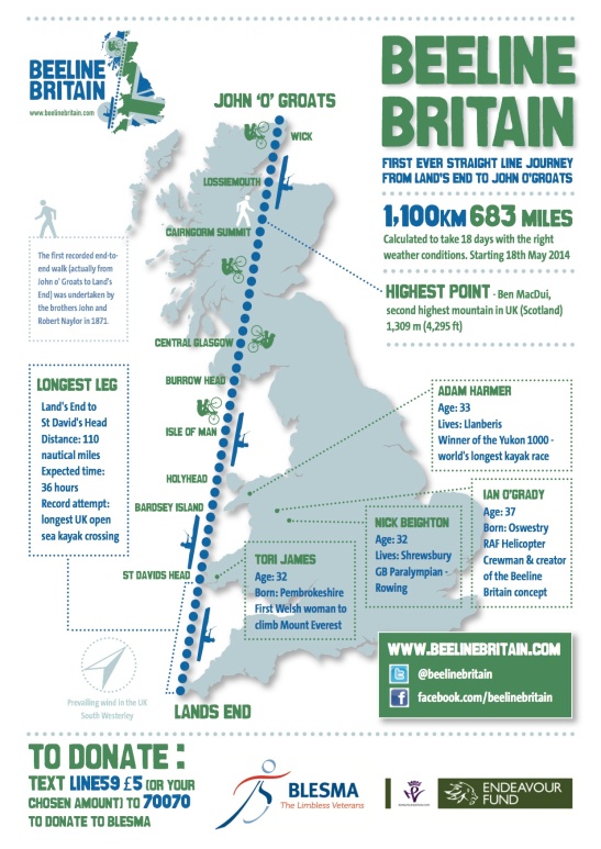
Route
The route is simple – Lands End to John O’Groats in a straight line! You may be surprised where it goes…
Lands End – St David’s Head – Bardsey Island – Holyhead – Isle of Man – Burrow Head – Central Glasgow – Cairngorm Summit – Lossiemouth – Wick – John ‘O’ Groats.
|
Distances Straight line vs Traditional Route 524 nm 760 nm 603 miles 874 miles 970 km 1407 km Speed and time Hours Kayak 301 nm @ 3kts 100 Bike 522 km @ 15km/h 34.8 Walk 25 km @ 2km/h 12.5 Total hours 147.3 1 hr moving = 1 resting 295 295hrs / 24 (number of days) 12.5 + 30% (weather / delays etc) 16 days Notwithstanding tides, wind and roads, it is entirely possible, and our aim, to stay within 15 km of track throughout. Our final track is likely to be around 1100km |
If you live on or near the route please come along and support us as we pass through. We will keep you informed on here and we will also be using GPS trackers so you can follow our every step.


